Borrego Springs
About 2 hours dirve and 80 some miles from Encinitas is
Borrego Springs, CA. Here you will find the Anza-Borrego State park which is
the largest state park in
California.
Anza-Borrego State Park was named after Juan Bautista de Anza, a Spanish explorer and Borrego, the name in Spanish for bighorn sheep. The best time to visit is from October to April as in summer, it is over 100 degrees F. If you have an RV, there are a number of commercial RV parks and you can camp for free (no amenities) almost anywhere in the state park as long as you follow a few simple rules.
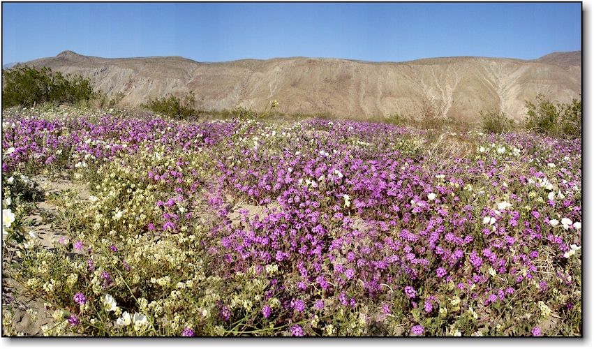
In Spring, many people come to the park (especially on weekends) to view the wildflower bloom. Generally, the best time is from late February through March. You can call the wildflower hotline at 760-767-4684 or sign up for a postcard notification when the flowers are expected to peak. For more information, visit the Anza-Borrego Desert State Park website.
TAKE WATER AND SURVIVAL GEAR WHEN TRAVELLING IN THE DESERT
 |
 |
 |
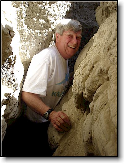
What we called "Beer Belly Canyon" |
Flowers in bloom - Coyote Creek |
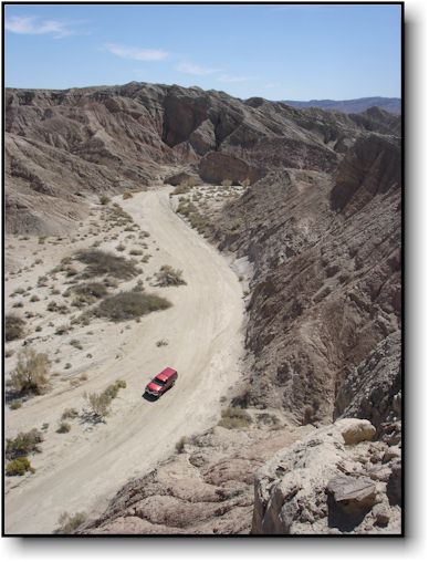
Many hikes and backroads |
click on image for larger |
click on image for larger |
click on image for larger |
Exploring the canyons, dirt roads, trails and caves of Anza-Borrego is a real treat. Some of our favorite spots are
1. Palm Canyon hike - about 3 miles round trip. Many of the palms were washed out during a 100 year flood on September 10, 2004. The trail starts from either the visitors center or the campground just north of it. We have seen bighorn sheep on this hike.
2. Hellhole Canyon: Trailhead and parking lot off the S22, just south of the Visitors Center. It starts out non-descript but gets very interesting after about a mile.
3. The Slot - a narrow slot canyon, easy to get to and fun to hike. Turnoff is on highway 78 about 1.5 miles East of the junction with Borrego Springs Rd. Dirt Road turnoff (Buttes Pass Rd.)at the following coordinates N33 09.500 W116 13.500 Drive about 2 miles. Road is passable by most cars. Park at the top of the canyon and hike down in.
4. Fonts Point - Take the turnoff and drive on a dirt road (passable with most cars) for 4 miles to the Fonts Pt. panorama lookout. No hiking required. See a panorama image here.
5. Arroyo Tapiado and the Mud Caves: This is a great canyon and has great hiking potential. Take Highway S2 toward Octillo. At mile marker 43 you will see a dirt road heading northwest to "Palm Spring" (GPS N32 54.972 W116 14.391 ). Take it but don't go to Palm Spring. Instead, follow the main track until you reach a left hand turnoff to "Arroyo Tapiado" about 4 miles along the way. There are many narrow canyons and mud caves to explore over the next 5 miles or so. Here are a couple: Beer Belly Canyon (GPS N32 55.222 W116 11.031 ) To the left, going up canyon, it gets narrower and narrower until well, you will get stuck.
Caves GPS N32 55.487 W116 11.321. A nice large mud cave about 100 meters long. Eventially opens up at the end. Cave 2 GPS N32 55.567 W116 11.442 Different, with two openings at the front and a single opening at the end. About 60 meters long. NOTE: Take backup flashlights whenever exploring caves. Do not enter them during rainstorms and remember that the ceilings do cave in at times!
Mud Canyon: This could be big mud cave, easily noticable from the road, GPS N32 55.637 W116 11.742 A bit of a cave at first then opened up into a canyon. Had some very soft mud in it.
If you are dirving a standard car up Arroyo Tapiado, don't go further in than the car can handle. Return via the road you came in on. Do not try to go to Highway 78 via Fish Creek Wash unless you are a serious 4-wheeler! Always carry survival gear in your car: blankets, food, water, shovel, matches etc. Cell phones do not work in these remote areas.
6. Wind Caves: Enter from the North side. Take highway 78 to Split Mountain Rd. Then Fish Creek Wash out past Split Mountain. Passable with most cars but do not attempt going past Wind Caves unless you have a high clearance 4X4. The track via Fish Creek Wash to Highway S2 is narrow and difficult with one particularly difficult part called "Diablo Dropoff". If you do attempt this from Arroyo Tapiado, the turnoff to Fish Creek from Arroyo Seco del Diablo is at N32 56.347 W116 11.398.
7. Wildflowers: Coyote Creek: Just past Christmas Circle in the center of town (Borrego Springs) go North on DiGiorgio Rd. It turns to dirt. Continue on for a mile or two for great views of the wildflowers (when in bloom) Purple and white.
More wildflowers: On the S22 between Borrego Springs and Fonts Point turnoff. We saw many yellow flowers right off the highway.
Watch our 7 minute movie - Wildflowers and exploring Arroyo Tapiado, March 2008
Enjoy your trip to Borrego!